Taking Control of Low-Altitude Airspace
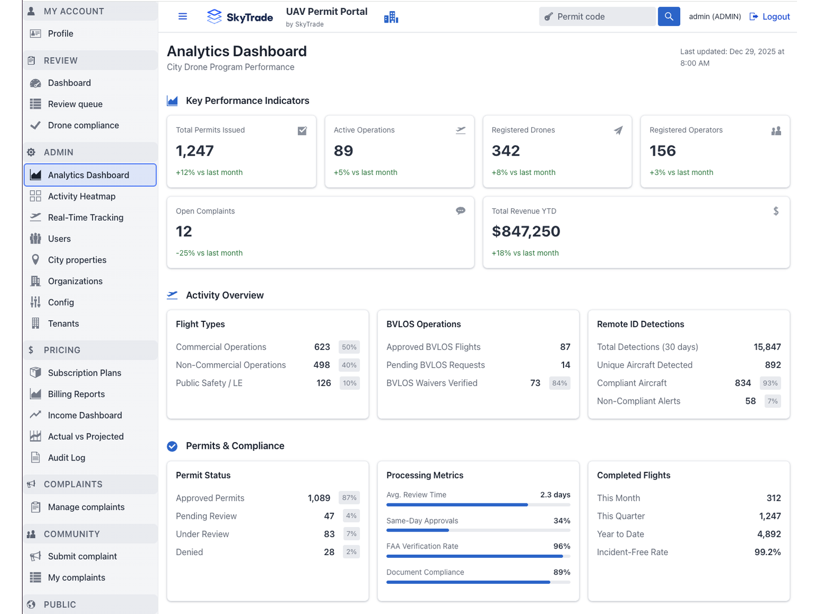
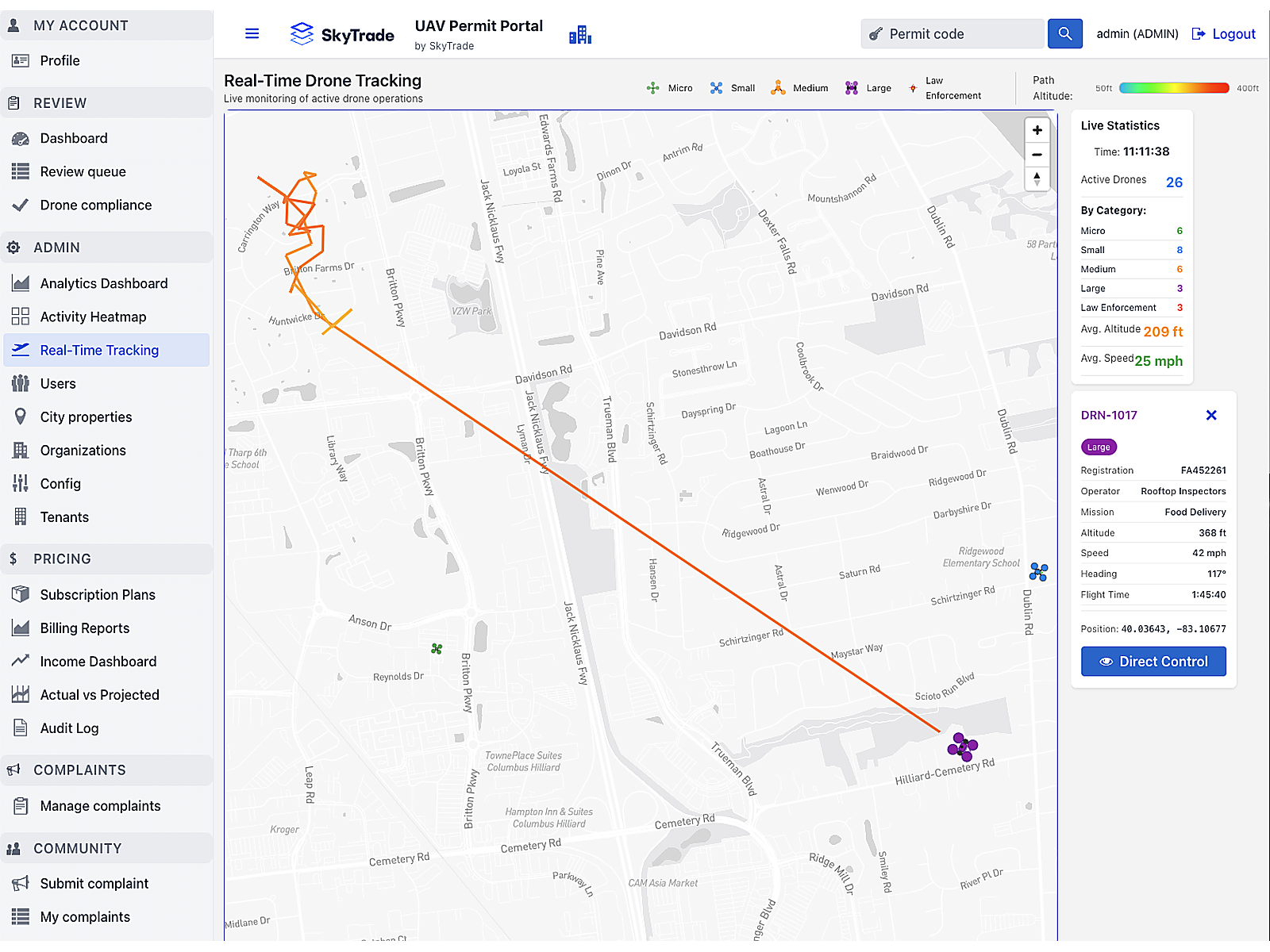
SkyTrade City helps municipalities take control of their low-altitude airspace. It provides the governance tools to issue permissions,
enforce safety, and align with FAA frameworks, while also unlocking new, recurring revenue through the leasing and management of air rights.
Built on transparency and community trust, SkyTrade City transforms the sky from an unmanaged gap into a regulated and profitable layer of city infrastructure.
Safe Skies
Comprehensive safety protocols and real-time monitoring for urban airspace
New Revenue
Transform airspace into a profitable municipal asset with multiple revenue streams
Public Trust
Build community confidence through transparent governance and accountability